Gibson Ridge Earth
In beta for nearly 16 months, this marks the culmination of what Gibson Ridge labs can produce. It's not only a radar visualization tool, but it's a swiss army knife of severe weather data visualization. AllisonHouse provides the data and backend technology to make it work, Gibson Ridge provides the software. With no integration of external data necessary, this is as plug-n-play as it gets.
Included Data
- National - Level 3 Radar Mosaic (includes)
- Raw reflectivity
- Quality Controlled (QC) Reflectivity
- Storm Tracks
- Hail Icons
- Mesocyclone Icons
- TVS icons
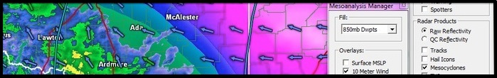
- Mesoanalysis Products (Fill)
- SBCAPE, MUCAPE, MLCAPE
- SBCIN, MUCIN, MLCIN
- MLLCL, MLLFC
- EBWD
- 1KM SRH, ESRH
- SCP, STP
- 2 Meter Temps, 2 Meter Dwpts
- 850mb Temps, 850mb Dwpts
- 700mb Temps, 700mb Dwpts
- 500mb RELV
- Mesoanalysis Products (Overlays)
- Surface MSLP, 10 Meter Wind
- 850mb Heights, 850mb Wind
- 700mb Heights, 700mb Wind
- 500mb Heights, 500mb Wind
- 300mb Heights, 300mb Wind
- Model Hours
- GFS 3hrs-192hrs
- NAM12 3hrs-84hrs
- HRW 1hrs-48hrs
- NAM4 1hrs-36hrs
- RAP 1hrs-18hrs
- HRRR 1hrs-7hrs
- Model Products (Fill)
- Reflectivity
- MLCAPE, SRH 0-3km
- 2m Temp, 850mb Temp
- 700mb VVEL, 500mb RELV
- Snow Depth
- 3hr Snow, 6hr Snow
- PType
- Model Products (Overlays)
- SRH 0-3km
- Surface MSLP, 2 Meter Temp
- 850mb Heights, 850mb Wind
- 700mb Heights
- 500mb Heights
- 300mb Heights
- GOES Satellite
- SPC Outlooks
- SPC Watches
- SPC Mesoscale Discussions
- NHC Products
- Wind Radii
- Category & Recon Icons
- GFDL Icons, HWRF Icons
- GFS Icons, TVCN Icons
- METARS
- Weather, Temperature, Dewpoint
- Wind, Wind Gust, Wind Chill, Heat Index
- GOES/Satellite Imagery
- Regions: East, Puerto, East Tropical, West Conus, Hawaii
- Products: Visible, Infrared, Water Vapor
- Warnings
- Marine
- Flash Flood
- Thunderstorm
- Tornado
- High resolution Landsat Background maps
- SpotterNetwork display
- Lightning (Local Summarized & CONUS)